
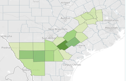
Magnolia’s Ferguson-McKnight activity illustrates why Eagle Ford development should be assessed across the broader lease footprint. While a full-section approach can help organize Permian development analysis, the supplied Ferguson-McKnight records connect multiple sections, surface pads and facilities under one lease name in Zavala and Dimmit counties. Combining well permits, spud dates, drilling rigs and air registrations provides a clearer view of how this development is progressing.

OilGasLeads’ seven-well sample identifies four surface clusters using a 50-metre transitive clustering method: three two-well pads in Zavala County and one single-well location in Dimmit County. These records represent a sample of the development rather than its complete well inventory.
A Lease-Level View of Development
All seven records carry the Ferguson-McKnight lease name and the Briscoe Ranch (Eagleford) field designation, but their surface locations span three section-and-abstract combinations.
County Section / Abstract Pads Well Records Zavala Section 533 / Abstract 1105 2 4 Zavala Section 276 / Abstract 581 1 2 Dimmit Section 631 / Abstract 98 1 1
Public records indicate a larger historical footprint. A 2010 Newfield drilling permit reported 30,170 acres for Ferguson-McKnight 526, while an El Toro completion filing for well 2801H reported 9,964 lease acres. These figures describe different historical filings and should neither be combined nor treated as Magnolia’s current net acreage. They nevertheless show that Ferguson-McKnight extends beyond the sections captured in this sample.
Permits and Spuds Reveal Different Development Patterns
The pad analysis shows both closely coordinated drilling and later returns to existing surface locations.
Pad First → Last Licence Date Licence Period First → Last Spud Date Spud Interval Contractor and Rig PAD-001 Feb. 2 → Dec. 4, 2024 306 days Feb. 16, 2024 → Jan. 13, 2025 332 days Patterson 233; H&P 541 PAD-002 May 30 → July 30, 2024 61 days Sept. 2 → Sept. 5, 2024 3 days H&P 541 PAD-003 Apr. 24 → Aug. 22, 2025 120 days Sept. 21 → Sept. 22, 2025 1 day H&P 475 PAD-004 Jan. 21, 2026 Single record Feb. 16, 2026 Single record H&P 475
PAD-002 also has consecutive licence numbers. Its three-day spud interval, alongside PAD-003’s one-day interval, is consistent with coordinated two-well drilling. PAD-001’s 332-day interval and change of rig suggest separate development visits.
All seven records have Activity Dates, the spud indicator used in this analysis. There are no “not yet drilled” records in the sample, although completion and production information is needed to establish subsequent project stages.
Horizontal Eagle Ford Development
Every sampled well is recorded as horizontal. PAD-001 and PAD-002 have projected depths of 8,500 feet, while PAD-003 and PAD-004 have projected depths of 7,000 feet. Combined projected footage totals 55,000 feet, which is planned depth—not verified footage drilled.
Section 533 contains both depth groups at separate surface clusters. This warrants further subsurface investigation, but the CSV does not identify landing zones or distinguish measured depth from true vertical depth. Coordinated multi-well development is supported; stacked reservoir development remains unconfirmed.
Air Registrations Add the Facility Dimension
Three air registrations identified as approved in 2026 cover Ferguson-McKnight Oryx H05 in Dimmit County, plus Axis H05 and H07 and the Ferguson-McKnight Compressor Station in Zavala County. All describe routine maintenance, startup and shutdown activities.
These records expand the development picture to include supporting facilities and compression. They do not, by themselves, establish new construction or increased production, and exact links to individual pads remain unverified.
Magnolia’s Eagle Ford Growth Platform
In its Q2 2026 earnings call, Magnolia described the proposed $4.06 billion WildFire acquisition as creating a larger South Texas growth platform. Management expected an initially roughly even mix of Eagle Ford and Austin Chalk development and identified opportunities to improve Eagle Ford drilling efficiency. The acquisition was still pending at the time of the call.
The combined Giddings position was expected to exceed 1.25 million net acres, with opportunities across the Austin Chalk, Eagle Ford and Woodbine. That broader corporate strategy provides context for Ferguson-McKnight, but does not establish its specific future drilling allocation.
What This Means for OFS Sales
Ferguson-McKnight should be tracked as a connected lease development with multiple surface locations and facility requirements. Sales teams can use new permits to identify drilling opportunities, spud dates to establish execution timing, and facility registrations to investigate compression and maintenance needs. In this sample, the next useful step is to verify completion, production and facility operating status before prioritizing follow-on services.


Author: phinds