
Surge Energy America’s well records for Block 33T1S in Howard County, Texas, show a development pattern built around multiple surface pads and horizontal wells with different projected depths. The supplied dataset contains 23 well records across nine coordinate-based locations, including 21 horizontal oil wells on seven multiwell pads and two separate vertical injection wells.

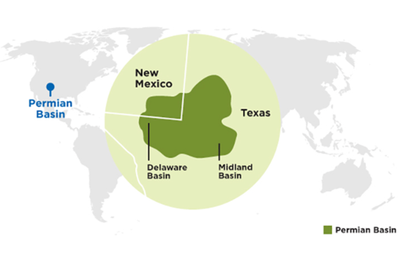
Located in the Northern Midland Basin portion of the Permian Basin, the block provides an example of how operators can organize development across several surface locations while potentially accessing multiple subsurface targets. The depth pattern is consistent with possible multibench development, although individual reservoir benches are not identified in the CSV.
Surface persona: concentrated development across three sections
All records fall within Block 33T1S, distributed across three section and abstract combinations.
Section Abstract Total wells Coordinate-based pads Development grouping 40 1146 8 2 RED HULK A and B 39 377 9 5 YODA A–E, PALPATINE A–B and two TUBB injection locations 38 1144 6 2 MIYAGI A–E and COBRA KAI D Total 23 9 Seven multiwell oil pads and two single-well injection locations
The surface pattern combines larger clusters, such as the five-well RED HULK A pad, with smaller two- and three-well developments. Different lease names sometimes share a coordinate cluster: MIYAGI A–C and COBRA KAI D form one four-well location under the 50 m transitive clustering rule.
Drilling records identify Latshaw 20 on eight wells, Latshaw 18 on five, and Latshaw 10 on six. Four records have no contractor or rig reported.
Subsurface persona: repeated depth groups suggest multiple targets
The 21 horizontal oil wells are classified under Spraberry (Trend Area) and have projected depths ranging from 7,200 to 9,300 feet. Across these wells, total projected depth is 176,000 feet, averaging approximately 8,381 feet per well. These figures describe the CSV’s projected depths, not verified footage drilled.
Several pads contain distinct projected-depth groups:
- RED HULK A: five wells at 7,200, 8,000, 9,000 and 9,300 feet.
- RED HULK B: three wells at 7,200 and 8,000 feet.
- YODA C–E: three wells at 7,200, 9,000 and 9,300 feet.
- MIYAGI A–C / COBRA KAI D: four wells divided equally between 8,000 and 9,300 feet.
These repeated depth groups suggest a development design that may reach vertically separated targets from shared surface locations. However, projected depth alone cannot establish reservoir benches: the file does not specify landing formations or whether the depth represents measured depth or true vertical depth. The appropriate classification is potential stacked or multibench development, pending confirmation.
The two vertical TUBB injection wells, projected to 9,900 and 10,170 feet, represent a separate subsurface function and are excluded from the horizontal-development totals.
Block development cadence: from the initial campaign to the newer pads
Period Recorded milestone Development significance November–December 2024 First licences for five horizontal pads containing 17 wells Establishes the initial permitted development group across RED HULK, YODA and MIYAGI / COBRA KAI locations. January 14–May 16, 2025 Activity Dates recorded for those 17 wells Shows drilling activity progressing across five pads over a 122-day first-to-last span. May 1–September 17, 2025 Completion dates reported for 16 of those 17 wells Completion reporting spans 139 days; one well remains without a reported completion date. September 2–4, 2026 PALPATINE A and B licensed Adds a two-well horizontal pad, with both wells projected to 9,000 feet. September 24–27, 2026 PALPATINE Activity Dates recorded First activity follows the pad’s first licence by 22 days; activity dates are three days apart. Neither completion date is reported. October 1, 2026 MIYAGI D and E licensed Adds the latest licensed pad in the supplied horizontal-well records: two wells projected to 9,000 feet, both treated as not yet drilled because Activity Dates are missing. November 9, 2026 YODA Battery new-registration notification action completed Adds a surface-facility filing milestone potentially associated with the earlier YODA development.
The chronology shows an initial multi-pad drilling campaign in 2025, followed by additional two-well locations in 2026. The latest licensed pad, MIYAGI D–E, represents a permitted development opportunity, while PALPATINE represents recorded drilling activity awaiting completion reporting.
YODA Battery adds a surface-facility signal
The supplied air-permit record identifies Surge Operating, LLC’s YODA Battery near Forsan, under Project 417103, Permit 185845 and Regulated Entity RN112559067. Its new-registration notification was received and marked complete on November 9, 2026.
The battery is a candidate match to the five YODA wells across two pads, whose reported completions occurred in July 2025. The filing therefore comes approximately 16 months after those completions. This is an administrative milestone; it does not establish when the battery was built or when the wells began producing. The exact well-to-battery connections remain unverified.
Block 33T1S illustrates a phased development pattern: multiple horizontal wells grouped at shared surface locations, repeated projected-depth targets, and subsequent additions to the permitted inventory. It is a credible multibench development prospect, with the strongest evidence coming from the multi-depth RED HULK, YODA and MIYAGI / COBRA KAI clusters.
Surge Energy America’s Block 33T1S in Howard County contains 23 wells across nine pad locations, including 21 horizontal oil wells on seven multiwell pads, with projected depths of 7,200–9,300 feet suggesting potential multibench development. The development progressed from a 17-well drilling campaign in 2025 to two additional two-well pads licensed in 2026, followed by the November 2026 YODA Battery air-permit notification, although specific reservoir benches and first-production dates remain unconfirmed.

Author: phinds