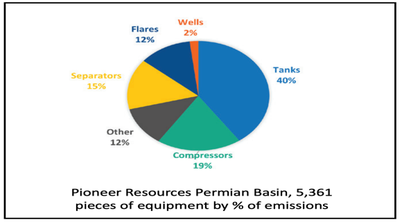
In the aerial surveys performed in the Permian Basin, 5,361 pieces of equipment were identified on 1450 facilities over 250 square miles using Gas Mapping LiDAR™ (GML) remote sensor technology. Out of these 5000+ pieces of observed
equipment, 6.0% were identified as emitters on the first pass.
Pioneer Natural Resources completes aerial surveys in the Permian