
Anadarko Basin had 859 wells drilled in 2022 by 143 Operators. The Anadarko Basin is a geologic feature covering approximately fifty thousand square miles primarily in west-central Oklahoma.
Anadarko Basin
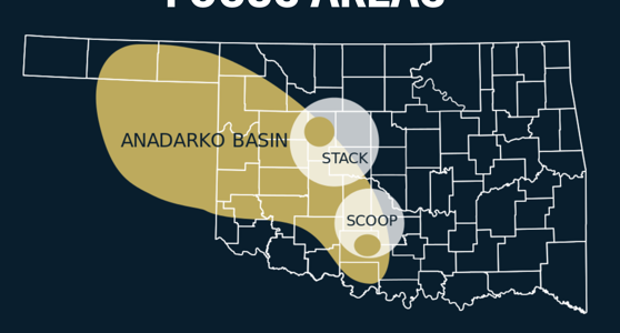
Anadarko Basin had 859 wells drilled in 2022 by 143 Operators. The Anadarko Basin is a geologic feature covering approximately fifty thousand square miles primarily in west-central Oklahoma.
Midland Basin includes Borden, Dawson, Martin, Midland, Upton, Reagan, Glasscock, Andrews, Crane, Gaines, Ector, Terry, Lynn, Howard and Irion counties and driven by development of the organic-rich, lower permeability units within the Wolfcamp and Spraberry formations.
Eagle Ford Shale is a hydrocarbon-producing geological formation located in Texas and named for the town of Eagle Ford, Texas
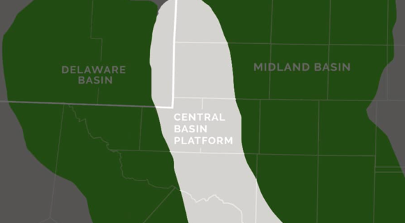
Delaware Basin map shows how it extends from Lea and Eddie counties, NM, in the north down to Pecos County, TX, in the south.
This page provides you with access to a list of Oil & Gas Operators active in the Permian Basin, wells drilled by the Operators and active drilling in the Permian.