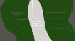
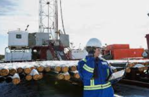
What is the Delaware Basin
The Delaware Basin is a major subsurface geological formation and one of the two primary basins within the larger Permian Basin.
Data Download Center
Oil & Gas Operator Account List Delaware Basin
Oil & Gas Operators active since 2021
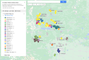
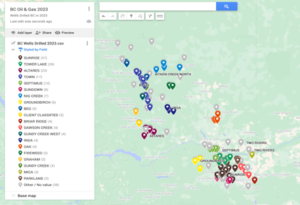
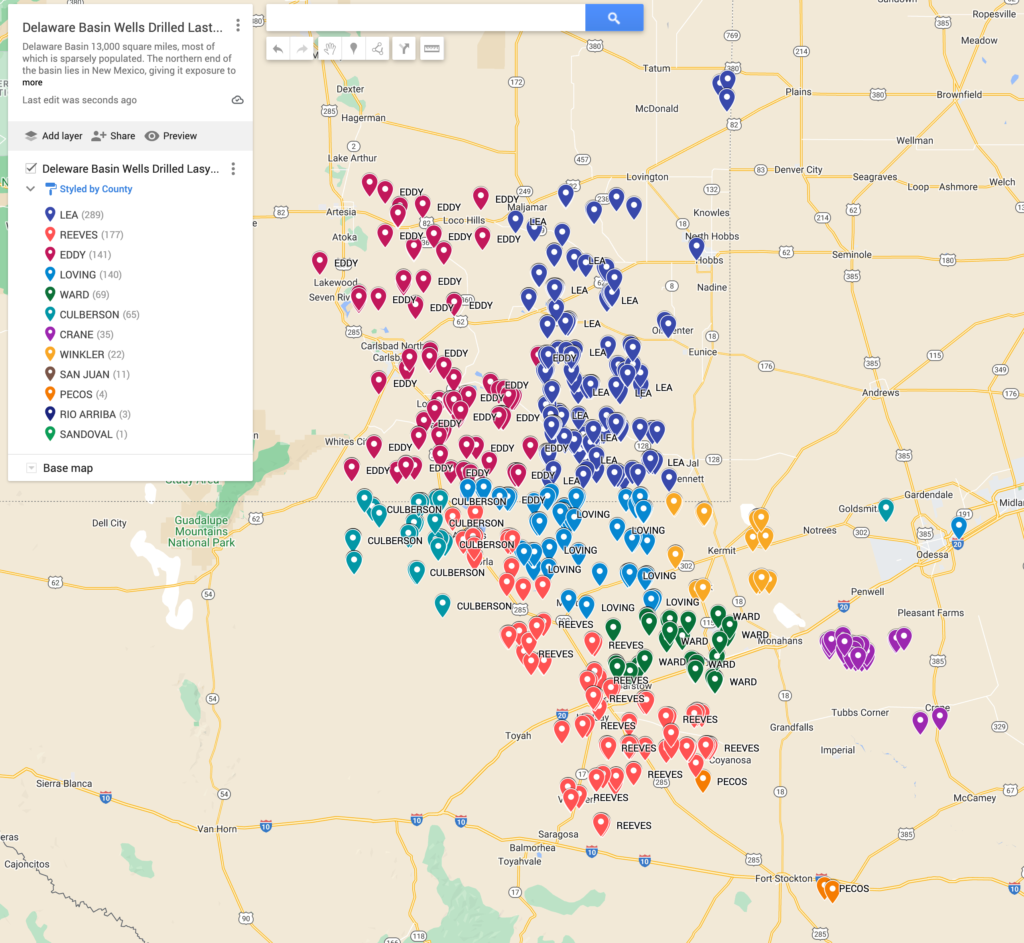
Wells Drilled in 2023 Delaware Basin
Rig Report Last 30 Days Delaware Basin
New Well Drilled Permits Last 12 Months Delaware Basin

About the Delaware Basin
The Delaware Basin is one of the two primary sub-basins within the larger Permian Basin, a major sedimentary basin located in the southwestern United States. The Permian Basin is renowned for its prolific oil and natural gas production, and the Delaware Basin, situated on the western side of the Permian, is a significant contributor to this output.
Here are key features and aspects of the Delaware Basin:
- Location: The Delaware Basin spans parts of West Texas and southeastern New Mexico. It is adjacent to the Midland Basin, which is the other primary sub-basin within the Permian Basin. Together, the Delaware and Midland Basins make up the broader Permian Basin.
- Geological Structure: The Delaware Basin, like the Permian Basin as a whole, is characterized by a complex geological structure with various layers of sedimentary rocks. These rocks include formations such as shale, limestone, and sandstone, which can serve as reservoirs for hydrocarbons.
- Hydrocarbon Resources: The Delaware Basin is known for its abundant hydrocarbon resources, including both oil and natural gas. It contains a mix of conventional and unconventional reservoirs. Unconventional resources, such as those found in shale formations, have become a significant focus of exploration and production activities.
- Economic Significance: The development of the Delaware Basin has had a substantial economic impact on the region and the United States as a whole. The basin’s production contributes significantly to the country’s total oil and gas output. This economic impact includes job creation, investment, and infrastructure development.
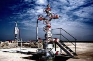
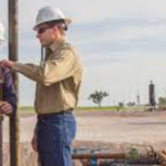
- Advancements in Technology: Advances in drilling technologies, particularly horizontal drilling and hydraulic fracturing (fracking), have played a crucial role in unlocking the hydrocarbon potential of the Delaware Basin. These technologies allow for the extraction of oil and gas from tight formations, such as shale.
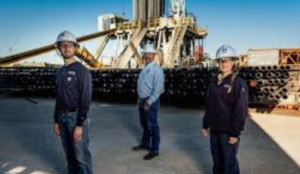
- Operators and Companies: Numerous energy companies, ranging from major corporations to independent operators, are active in the Delaware Basin. The basin has attracted significant investment and attention from the global energy industry.
- Infrastructure: The Delaware Basin is well-connected through an extensive network of pipelines and other infrastructure that facilitates the transportation of oil, natural gas, and related products. This infrastructure links production areas to refineries, processing facilities, and markets.
The Delaware Basin, along with the Midland Basin, has been a focal point of the U.S. shale revolution. The combination of advanced drilling technologies and abundant hydrocarbon resources in these basins has contributed to the United States becoming a leading global oil and gas producer. The ongoing development and production activities in the Delaware Basin continue to shape the energy landscape in the region and beyond.
Who are the top 10 Oil & Companies in the Delaware Basin
The list below is a summary of the top 10 Oil & Gas Producers in Delaware Basin by wells drilled in 2024.
1/ EOG Resources, Inc. ranks #1 with 375 records. Official website: https://www.eogresources.com/
2/ Mewbourne Oil Company ranks #2 with 315 records. Official website:
3/ OXY USA Inc. ranks #3 with 286 records. Official website: https://www.oxy.com/
4/ Devon Energy Corporation ranks #4 with 267 records. Official website: https://www.devonenergy.com/
5/ Permian Resources ranks #5 with 247 records. Official website: Not readily available.
6/ Coterra Energy ranks #6 with 247 records. Official website: https://www.coterra.com/
7/ Chevron U.S.A. Inc. ranks #7 with 220 records. Official website: https://www.chevron.com/
8/ ConocoPhillips Company ranks #8 with 193 records. Official website: https://www.conocophillips.com/
9/ XTO Energy Inc. ranks #9 with 187 records. Official website: https://www.xtoenergy.com/
10/ Matador Resources Company ranks #10 with 132 records. Official website:
Oil & Gas Contacts


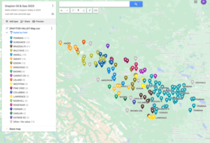
Delaware Basin Map
The counties of the Delaware Basin stretch from Eddy county, New Mexico in the north to Pecos county, Texas in the south. Population sizes range from less than 200,000 in Lea, Eddy, and Chaves Counties in New Mexico to the sparsely populated Loving County of Texas with just over 100 residents. The counties below are located in the Delaware map.
Key characteristics of the Delaware Basin include:
- Location: The Delaware Basin spans parts of West Texas and southeastern New Mexico. It is one of the most prolific oil and gas-producing regions in the United States.
- Geological Formation: The basin is characterized by a complex and layered geological structure. It contains a mix of conventional and unconventional reservoirs, including shale formations. The basin’s geological complexity has made it a target for advanced drilling and extraction technologies.
- Hydrocarbon Resources: The Delaware Basin is rich in hydrocarbon resources, including both oil and natural gas. Advances in drilling techniques, such as horizontal drilling and hydraulic fracturing (fracking), have enabled the extraction of oil and gas from tight formations like shale.
- Economic Significance: The development of the Delaware Basin has had a significant economic impact on the region and the United States as a whole. The basin’s production contributes significantly to the country’s total oil and gas output.
- Operators and Companies: Various energy companies and operators are active in the Delaware Basin, exploring and developing oil and gas resources. The basin has attracted attention from both large and independent oil and gas companies.
- Midland Basin Connection: The Delaware Basin is adjacent to the Midland Basin, the other primary basin within the Permian Basin. Together, the Delaware and Midland Basins make up the Permian Basin, which has become a key player in the global energy landscape.
The Permian Basin, including the Delaware Basin, has undergone a significant boom in oil and gas production in recent years, driven by technological advancements and the development of shale resources. It continues to be a major focus for energy exploration and production activities in the United States.
CITIES OF THE DELAWARE BASIN
The cities of the Delaware Basin are spread out along its vast 6.4M acre area and include Mentone, a remote town in Loving County, Texas with a population of 29. The largest city in the basin area is Odessa, Texas. The cities below are located on the Delaware basin map.
| City | Wells Drilled 2021 |
| MENTONE | 289 |
| ORLA | 214 |
| PECOS | 172 |
| PYOTE | 45 |
| Coyanosa | 41 |
| Verhalen | 41 |
| MONAHANS | 33 |
| Barstow | 29 |
| KERMIT | 27 |
| Wink | 19 |
| Ft. Stockton | 1 |
Oil Gas Operators